On a hill overlooking Millerton Lake in Fresno County a group of workers are gathering around a cell tower. They’re watching a tiny white drone slowly circle the tower from the ground all the way to the top. Quasie Jones is with the drone imaging company Skycatch.
"It was a drone that flew that and made that determination and told that technician." - Art Pregler, AT&T
“So what it’s doing is taking a picture every two seconds,” Jones says. “So by the end of it it’ll basically have probably like five or 600 photos. So then our technology renders that and creates a 3D model.”

After the model of the tower is created the drone can then make decisions on its own on on whether there’s anything wrong. It does this by comparing previous photos and video of the tower with what’s recorded today. If there's anything off then it notifies AT&T. It’s a dangerous job that can take hours if done by a person. Art Pregler with AT&T’s Drone Program says his team’s fed thousands of photos and video into an algorithm to teach the drone what to look for.
“A technician will just get a trouble-ticket saying there’s this type of defect at this location that they need to go fix,” says Pregler. “However it was a drone that flew that and made that determination and told that technician.”
Pregler says AT&T isn’t getting rid of people for tasks like this, it’s just streamlining work on the company’s nationwide system of around 65,000 networks and more than 100,000 projects. A drone operator is still needed to run the drone and technicians are still needed to fix anything the drone finds wrong with the cell tower. He says using drones creates safer conditions for the 15,000 technicians AT&T employs especially when they’re working on towers that range from 60 to 400 feet tall.
“We can fly the drone before the tower climber ascends the tower so they know the condition of the tower, they know the condition of the safety equipment on the tower,” says Pregler. “They know what equipment and tools to bring with them when they make that climb.”

The company is also using drones to provide internet service to rural areas. Pregler says they hope to use helicopter sized drones tethered to the ground equipped with WIFI technology to bring high speed internet to remote places in the U.S. He says technology like this should be ready by 2020.
“If there’s an event throughout the day that requires additional capacity the network can dispatch a drone there, provide that extra coverage where it needs and then when the coverage needs goes away the network will tell the drone to return or go to another location,” says Pregler.
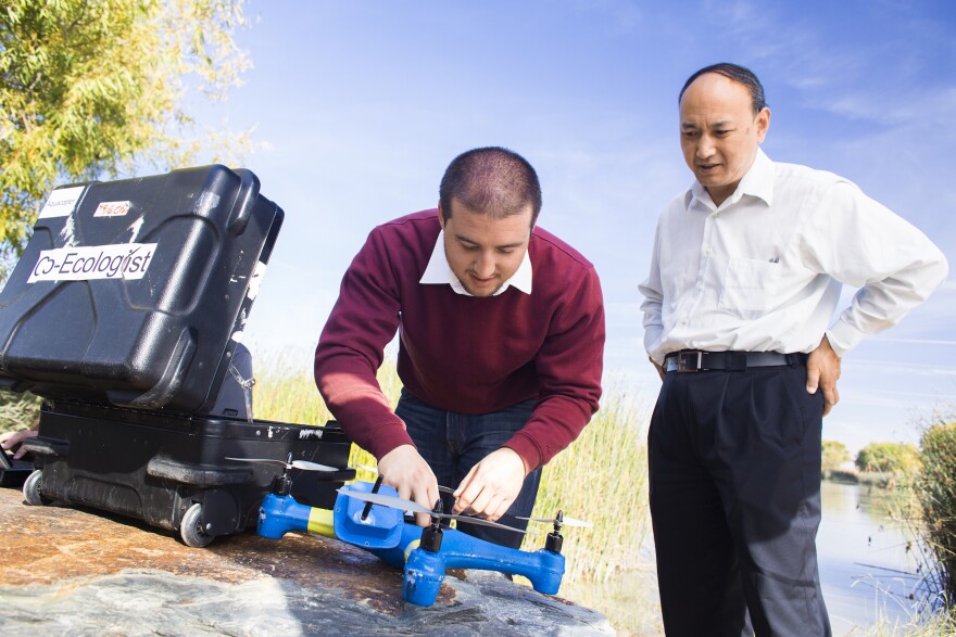
AT&T isn’t alone in using drones to optimize their procedures. UC Merced’s drone lab at the old Castle Air Force Base in Atwater is working on a number of projects using drones to do jobs that are too time consuming for people. Dr. YangQuan Chen created the lab when he began teaching at UC Merced in 2012.
"There's a huge safety concern on leaks that go undetected and then also concerns on surveillance." - Derek Hollenbeck, UC Merced
“We use drones as a vehicle to attract more students into the STEM area,” says Chen. “It stands for Science, Technology, Engineering and Math. So we started from having a summer academy for high school students.”

Chen also has undergraduate and graduate students working on drone related projects. One of them uses technology from NASA called a sniffer that analyzes dust for signs of life on Mars. UC Merced uses smaller version that they attach to their drones that fly over natural gas pipelines to find leaks. This is PHD Student Derek Hollenbeck’s project.
“There’s a huge safety concern on leaks that go undetected and then also concerns on surveillance,” says Hollenbeck. “There was an incident in Bakersfield where a construction worker excavated on a main line and it blew up. And it killed him and a few others.”
His project already gained traction with companies like PG&E during tests in 2016 to detect methane leaks at the company's test community in Livermore. The drone program also partnered with Baltimore Gas and Electric in real life situations to detect leaks.
“To develop that confidence level to say okay with the two passes and our algorithm we can save with 90 percent accuracy it’s this house right here,” says Hollenbeck. “For them that's good enough because they have to use their handheld instruments to pinpoint it.”
The miniature sniffer used by NASA’s Jet Propulsion Laboratory is around a 1,000 times more sensitive than most technology available. Hollenbeck says using this tech on drones could be a major turning point in detection capabilities for gas companies. Imagine drones flying around neighborhoods on their own instead of maintenance workers manually looking for leaks. Hollenbeck says one of the main things holding back his research are flight rules around drones.
“But I believe over the next few years when we get things like the NASA UTM, which is unmanned aerial systems traffic management, it might open these avenues where we can have flight rules for drones doing these things like surveillance,” Hollenbeck says.
And this is just one use that UC Merced is using drone technology to experiment with. They are also using drones in South America to map caves and are developing drones that can land and take off on water. This is all part of the university's goal of putting UC Merced on the map when it comes to drone technology.


