A new ranking of environmental health in California shows that many Fresno County neighborhoods rank among the worst in the state when it comes to pollution.
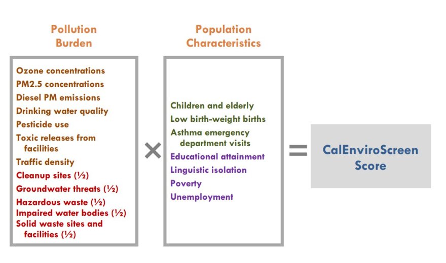
The California Office of Environmental Health Hazard Assessment's CalEnviroScreen 2.0 database examines how the state's approximately 8,000 census tracts rank on a variety of indicators in two major areas: pollution exposure and socioeconomic factors that increase vulnerability to pollution. The database combines the two to give each tract a score.
Of the 25 highest scoring census tracts in the state, 16 were from Fresno County. Only Los Angeles County had more neighborhoods in the top 100 list with 41. Fresno County had 24, and Kern County had 7.

The CalEnviroScreen score is designed to reflect the cumulative impacts of pollution on public health, and is derived from a variety of indicators. The pollution exposure section incorporates data on everything from ozone, PM2.5, and diesel emissions to pesticides, traffic density and drinking water quality.
The socioeconomic section attempts to rank communities based on factors that researchers say make certain groups more vulnerable to pollution. Indicators in that section include the unemployment rate, educational attainment, linguistic isolation and poverty. It also includes data on populations that are especially sensitive to pollution such as young children, expectant mothers and the elderly.
Officials with the California Environmental Protection Agency say they hope to use the new analysis to identify areas that face multiple pollution burdens, and target future programs and funding to those areas.
See an interactive map showing your neighborhood's CalEnviroScreen 2.0 score...
See a ranking of all of California's census tracts by their CalEnviroScreen 2.0 score... (Excel spreadsheet)


