A new way to measure the snowpack from the sky is getting some positive results. FM89's Ezra David Romero reports officials hope new technology can reduce the risk of downstream flooding.
At the start of the year NASA crews began flying over the San Joaquin River watershed to measure the snowpack using laser pulses. This creates a way more accurate estimate of how much snow is the mountains than traditional snow surveying does.
Jeffrey Payne with the Friant Water Authority says from the end of January to now the snowpack in this area of the Sierra alone grew from 1.2 to 2.7 million acre feet of water.
"Last month we were seeing depths of 50 feet and currently they are 75 feet or higher," says Payne. "A few of the snow drifts have faces that are 25 to 45 feet high. There's quite a bit of snow in the upper watershed."

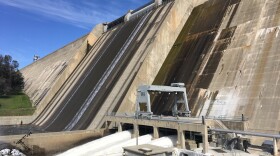
In preparation for all that snow to melt Payne says releases are continuously being made out of Friant Dam at about 9,000 cubic feet per second.
"If we get much higher than where we're at right now we might start seeing some properties evacuated, which would be really unfortunate," says Payne. "The hope is that we can use this survey to inform how much water we're releasing so we can avoid downstream impacts and all that we also end up with a full reservoir at the of the year."
Water is also being released down both the Madera and Friant-Kern Canals for groundwater recharge in preparation for spring runoff.


